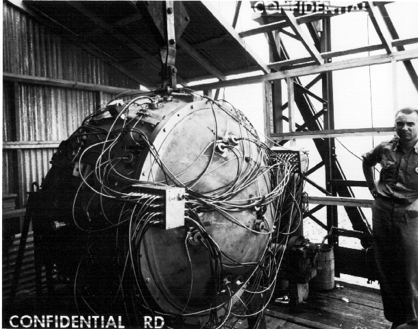
Photos and Maps of Trinity (Atomic Test) Site
“Photos and Maps of Trinity (Atomic Test) Site” is a book that delves into the historical context and geographical details of the Trinity test site in New Mexico, USA. The author presents extensive maps and rare historical photographs to guide readers through the pivotal moment of the world’s first nuclear test and its profound impact on global politics and military landscapes.
Gallery

About This Ebook
This book not only offers numerous high-resolution maps and photographs of the Trinity test site but also provides detailed descriptions of the preparation processes before and after the test, as well as the experiences of those involved. It includes many previously unpublished archival materials, revealing the intricate workings of scientists at the Los Alamos Laboratory. The book also explores the ethical questions behind nuclear weapon development. Furthermore, the author analyzes the role of the Trinity test in shaping international relations during the Cold War era, providing readers with a comprehensive understanding of the significance of this historical event.